Storms During the Week, Cool during The Coming Weekend
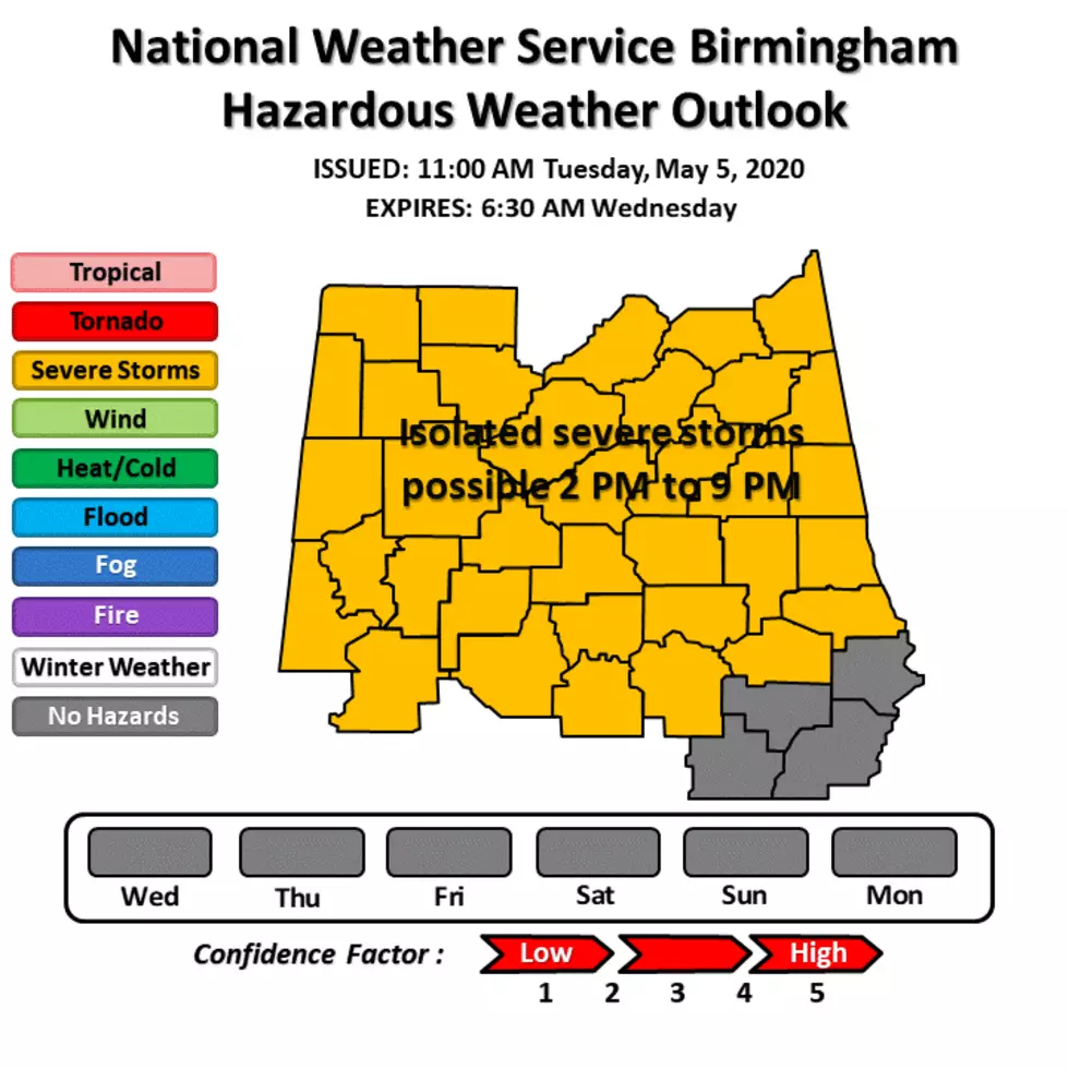
There is a Marginal Risk for severe weather across West and central Alabama this afternoon and evening. A cold front is moving into Alabama today and is expected to set off showers and a few thunderstorms between 2:00 pm and 9:00 pm. Some of the thunderstorms could be strong to severe.
The main risk from these storms are damaging winds to 60 mph and quarter size hail. Warm air aloft could inhibit severe development. Keep listening, if severe weather breaks out we will break in.
National Weather Service computer models continue to show a very strong cold front moving through the state on Friday. Chance of precipitation is 80-percent. This could produce a few strong to severe thunderstorms but confidence remains low due to the current forecast of limited low-level moisture to provide fuel for thunderstorm growth.
This weekend should get all of our attention as temperatures will be unseasonably cool. Temperatures will struggle to get into the 60's over the northern half of Alabama Saturday afternoon. Lows will be mainly in the 40's statewide overnight Sunday and Monday evenings. Believe it or not there could be some frost in the colder valleys of north Alabama. If it occurs, this would break the record for the latest frost in Alabama history. May 7th, 1944 currently holds the record.
After the weekend, the weather pattern bringing the unusually chilly temperatures will moderate a bit, but there is still a likelihood of below average temperatures through the middle of the month.
The latest Climate Prediction Center outlooks show colder-than-average weather for most of the eastern United States through May 18th. But don't complain, at least we are not in the upper Midwest where there is actually snow in the forecast for this coming weekend.
--
This is also Hurricane Season Preparedness Week. Although West Alabama is more than 200 miles from the coast, tropical systems making landfall can cause tornadoes, damaging winds and torrential rainfall hundreds of miles inland. More people typically are killed and injured inland from tropical storms and hurricanes than there on the coast. Storm surge is the mainly killer on the coast.
The hurricane season in the Atlantic Basin, which includes the Gulf of Mexico, begins on June 1st and ends on November 30th. The peak of the hurricane season for the Central Gulf of Mexico is late August through mid-November.
Although Category 5 Hurricane Michael did catastrophic damage to the Florida Panhandle in October of 2018, you have to go back to 2004 for the last time Alabama took a direct hit from a hurricane, and that was Hurricane Ivan, a Category 3 storm that made landfall in Gulf Shores. “That's 15 years — it's a long time,” said Jason Beaman, the warning coordination meteorologist with the National Weather Service in Mobile.
Ivan is still the most expensive hurricane to strike Alabama.
More From Catfish 100.1