Severe Weather Threat Live Coverage Updates for West, Central Alabama
Here is where you will find all the latest weather information you need to stay informed.
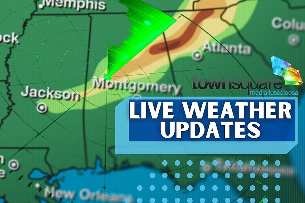
Current Advisories, Watches, & Warnings:
BMX continues Severe Thunderstorm Warning [tornado: POSSIBLE, thunderstorm damage threat: CONSIDERABLE, wind: 70 MPH (RADAR INDICATED), hail: 0.75 IN (RADAR INDICATED)] for Greene, Pickens, Sumter [AL] till 9:45 PM CDT
BMX issues A STRONG THUNDERSTORMS WILL IMPACT PORTIONS OF MARION, WESTERN FAYETTE, AND LAMAR COUNTIES THROUGH 930 PM CDT for Fayette, Lamar, Marion [AL] till 9:30 PM CDT
BMX extends the area of Severe Thunderstorm Watch for Bibb, Dallas, Perry [AL] till 11:00 PM CDT
The National Weather Service has issued a Severe Thunderstorm Watch for Fayette, Greene, Hale, Lamar, Marengo, Marion, Pickens, Sumter, Tuscaloosa, Walker, Winston [AL] till 11:00 PM CDT
There is a Wind Advisory going on now until Thursday, April 14, 2022, until 1 a.m. for the following counties;
Fayette
Marion
Lamar
Pickens
Tuscaloosa
Walker
Winston
The National Weather Service in Birmingham Highlights
Where:
All of Central Alabama
When:
This Evening (7PM) through early Thursday (6 AM)
Threats:
Tornadoes
Damaging winds up to 60 mph, with potential for 70 mph winds in the "Enhanced Risk" area
Quarter-size hail
Localized Flooding in low-lying or poor drainage areas
Click here for an extensive everything you need to know about the possible severe weather for tonight, late night, and tomorrow morning. Current details on areas, threats, and timelines.
(Source) For more from the National Weather Service Birmingham, click here.
LOOK: The most expensive weather and climate disasters in recent decades
KEEP READING: Get answers to 51 of the most frequently asked weather questions...
KEEP READING: What to do after a tornado strikes
TIPS: Here's how you can prepare for power outages
More From Catfish 100.1