Remnants of Laura Could Affect Alabama on Friday
Remnants of Laura Could Affect Alabama on Friday
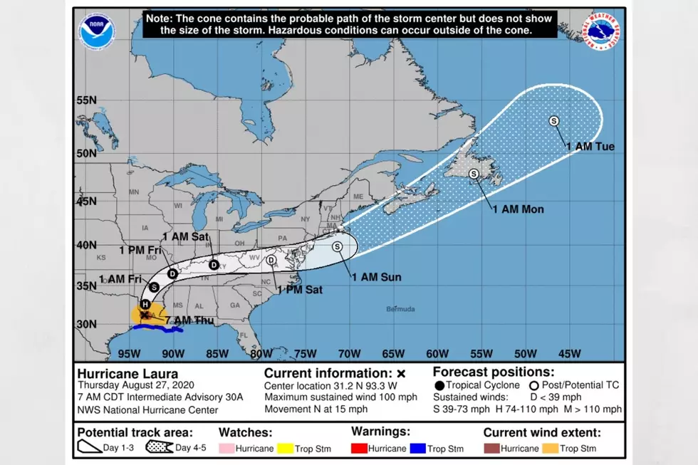
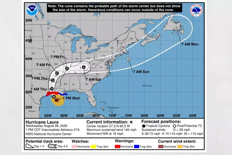
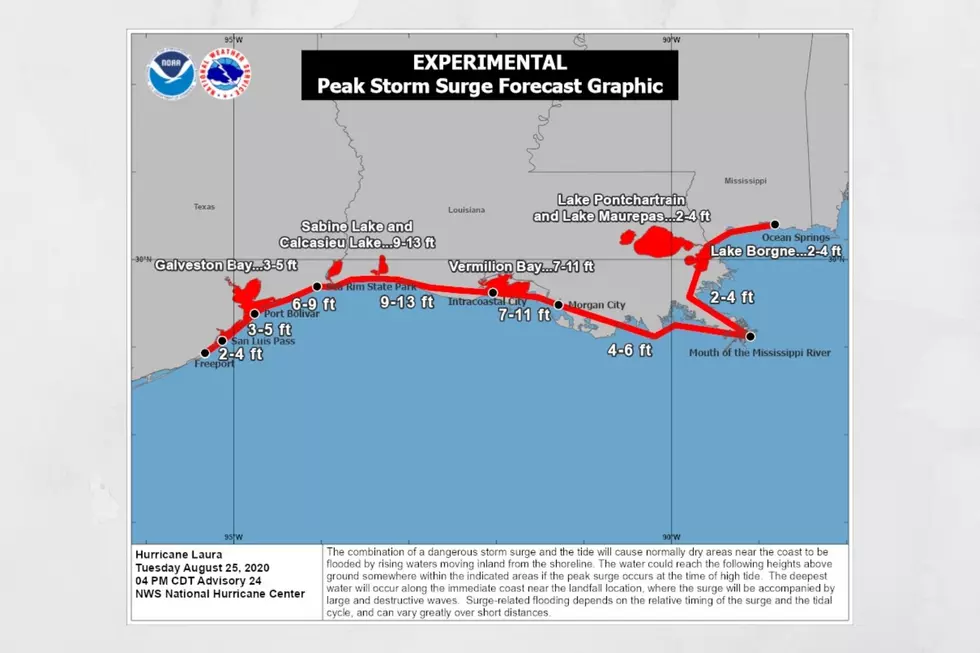
We all have watched the coastline become battered by Marco and Laura. Our thoughts go out to all affected by those systems. It truly is hard to hear the reports of damage and potential loss of life. Therefore, I wanted to give you as much “heads up” for what the remnants of Laura could bring to Alabama on Friday, August 28, 2020. I want to stress that this information could change with any path changes with Laura.
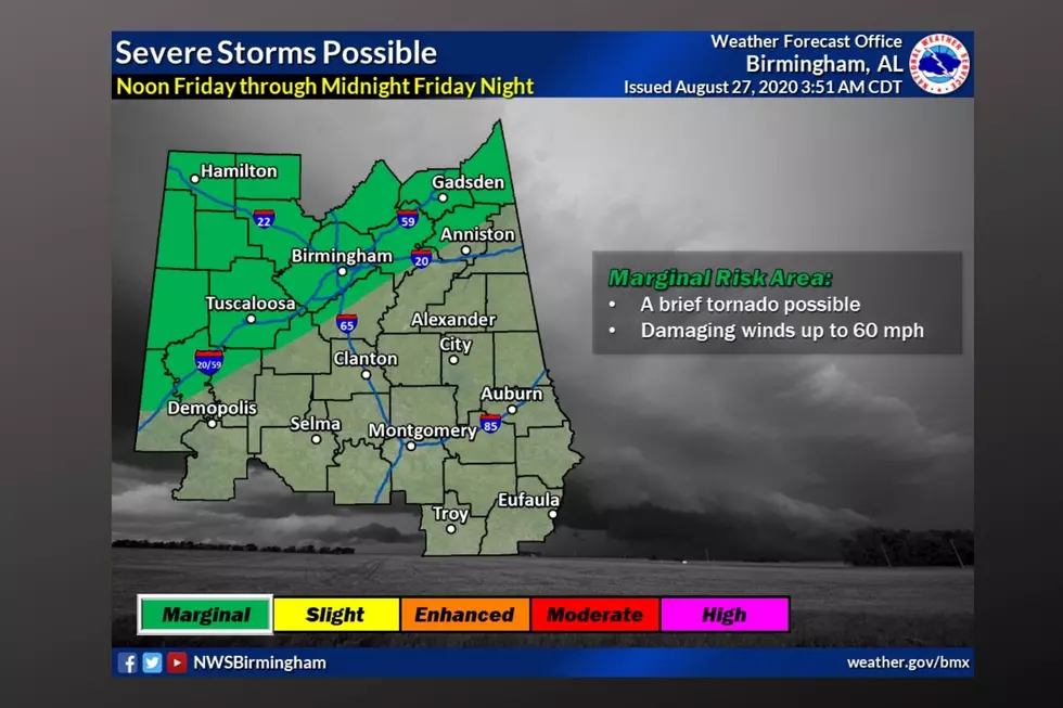
According to the National Weather Service, there is a Hazardous Weather Outlook, with a timeline between Noon Friday through Midnight Friday Night. Current thoughts are that “the remnants of Laura could bring a threat for damaging winds or a brief tornado from noon Friday to midnight Friday night. The threat is expected to include areas near and northwest of Interstate 59.”
This outlook affects the following counties: “Marion-Lamar-Fayette-Winston-Walker-Blount-Etowah-Calhoun-Cherokee-Cleburne-Pickens-Tuscaloosa-Jefferson-Shelby-St. Clair-Talladega-Clay-Randolph-Sumter-Greene-Hale-Perry-Bibb-Chilton-Coosa-Tallapoosa-Chambers-Marengo-Dallas-Autauga-Lowndes-Elmore-Montgomery-Macon-Bullock-Lee-Russell-Pike-Barbour.”
As always, our Townsquare Media radio stations, along with the Tuscaloosa Thread will be on stand by for any severe weather coverage to keep you informed and safe. I suggest that you are staying weather aware on Friday. A great way to do that is to download our free app. Here is the information:

(Source) For more from the National Weather Service, click here.
More From Catfish 100.1