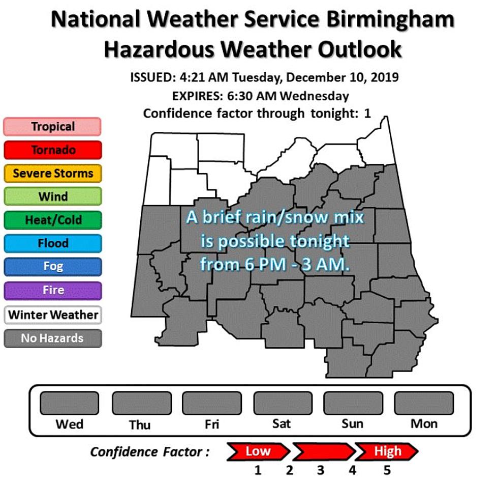
Details For Active Weather On Monday
Details for Active Weather on Monday
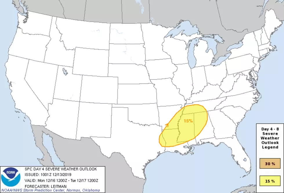
We have the potential for active weather on Monday, December 16, 2019. I am closely monitoring this because of the potential severe weather threat, which includes a possibility for tornadoes, damaging straight-line winds, and hail (up to a quarter-sized).
At this time, the expected arrival of severe weather will be Monday afternoon into Monday night. The National Weather Service at this time is indicating that the risk time frame will be between 2 pm until 2 am. As we get closer to Monday, this timeline could be adjusted. Also, the risk levels are more aligned with the northern and western areas of Alabama. Monday’s high is expected to be in the low 70’s for the majority of our listening areas.
The Hazardous Weather Outlook from the National Weather Service Birmingham is for the following counties: Marion-Lamar-Fayette-Winston-Walker-Blount-Etowah-Calhoun-Cherokee-Cleburne-Pickens-Tuscaloosa-Jefferson-Shelby-St. Clair-Talladega-Clay-Randolph-Sumter-Greene-Hale-Perry-Bibb-Chilton-Coosa-Tallapoosa-Chambers-Marengo-Dallas-Autauga Lowndes-Elmore-Montgomery-Macon-Bullock-Lee-Russell-Pike-Barbour.
I will continue to monitor as we get closer to Monday and provide updates for you. @MaryKRadio – Weather Reporter

More From Catfish 100.1

![Warning: Could Your State Have the Most Dangerous Drivers? [Infographic]](http://townsquare.media/site/241/files/2019/12/samuele-errico-piccarini-MyjVReZ5GLQ-unsplash.jpg?w=980&q=75)