Alabamians Be Weather Aware Today, Potential for Severe Weather
Alabamians Be Weather Aware Today, Potential for Severe Weather

It’s the day before Thanksgiving, and I’m sure everyone is preparing for their holiday and long weekend. I encourage you to be weather aware today. There is the potential for severe weather.
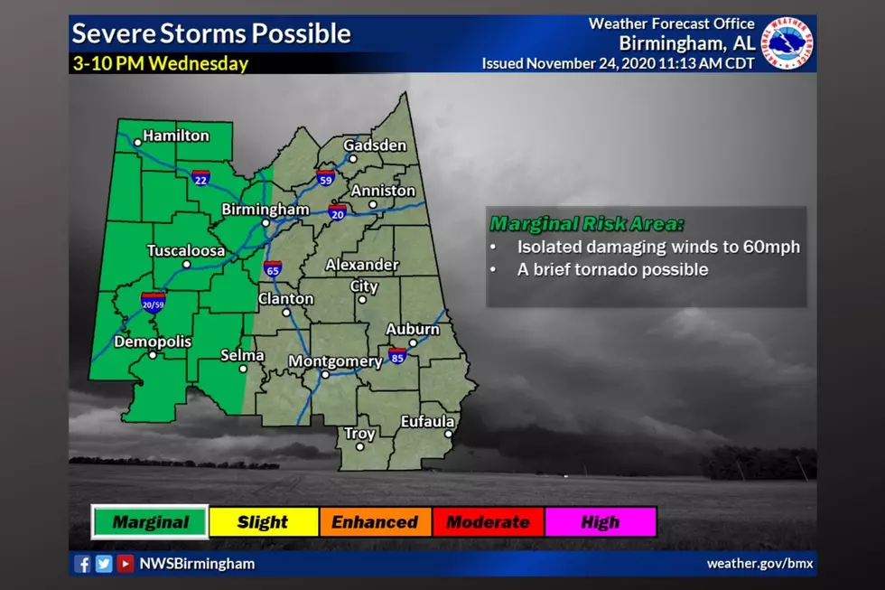
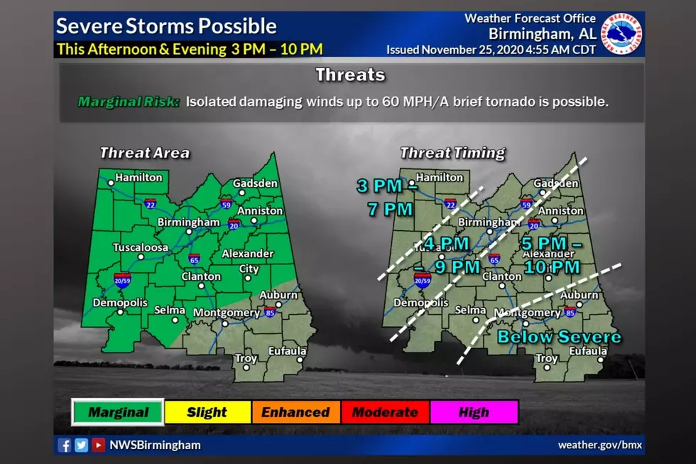
There has been an update to the area in which the marginal risk area covers. It now covers all of our radio stations' listening areas. The time frame for the possible activity is between 3 pm until 10 pm.
According to the National Weather Service Birmingham, the main threats are “isolated damaging winds up to 60 mph, and a brief tornado is possible.” The NWS also notes that “the cold front is approaching Mississippi this morning with showers and storms ahead of the boundary. We have maintained a low-end chance for a few strong storms this afternoon/evening (3-10 PM) and have expanded the Marginal risk area further east, excluding our southeast counties.”
As you are going about your day, please keep the weather in mind. In the Hazardous Weather Outlook, the National Weather Service Birmingham also gave us insight into their area of concern: “along and north of a line from Selma to Alexander City. Damaging wind gusts will be the primary concern, although a brief tornado cannot be ruled out.”
The counties involved with this Hazardous Weather Outlook are: “Marion-Lamar-Fayette-Winston-Walker-Blount-Etowah-Calhoun-Cherokee-Cleburne-Pickens-Tuscaloosa-Jefferson-Shelby-St. Clair-Talladega- Clay-Randolph-Sumter-Greene-Hale-Perry-Bibb-Chilton-Coosa-Tallapoosa-Chambers-Marengo-Dallas-Autauga-Lowndes-Elmore-Montgomery-Macon-Bullock-Lee-Russell-Pike-Barbour.”
The Storm Prediction Center has issued a low end "marginal risk,” which is level 1 out of 5 for much of the state through tonight. As always, I suggest being weather aware.

(Source) For more from the National Weather Service Birmingham, click here.
The Colors Of The Sky
More From Catfish 100.1