Severe Thunderstorms, Tornadoes Possible in Tuscaloosa, Alabama Wednesday Night
Another round of severe weather is in the forecast for Tuscaloosa this week.

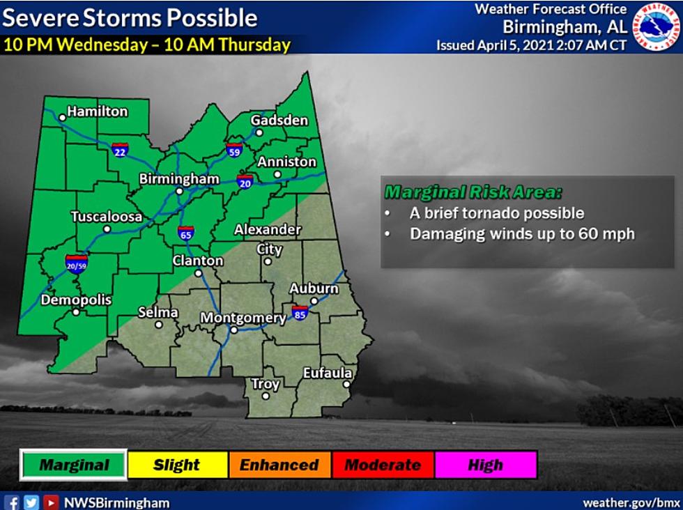
The National Weather Service in Birmingham has placed all of West Alabama under a marginal risk for severe weather Wednesday night. Storms could produce damaging winds of up to 60 miles an hour as well as brief tornadoes.

ABC 33/40 Chief Meteorologist James Spann says storms will be possible Thursday as well:
For now it looks like the storms will be weakening as they enter West Alabama Wednesday night sometime after 10:00 p.m. But, they could still produce strong winds and some hail. A low chance of a brief, isolated tornado.
Storms will end early Thursday morning as a dry slot moves into the state… a decent part of the day Thursday looks dry with some sun possible and a high in the upper 70s. Then, another wave rotating around an upper low to the north will bring another batch of rain and storms into the state Thursday night. Again, they could be fairly heavy with strong winds and some hail possible.
With overnight storms, it's imperative to have a way to receive weather alerts and warning information. Details on TUSCAlert, a free weather notification service, can be found HERE.
LOOK: 30 fascinating facts about sleep in the animal kingdom
More From Catfish 100.1