UPDATED: Hazardous Weather Outlook For Today
UPDATED: Hazardous Weather Outlook For Today
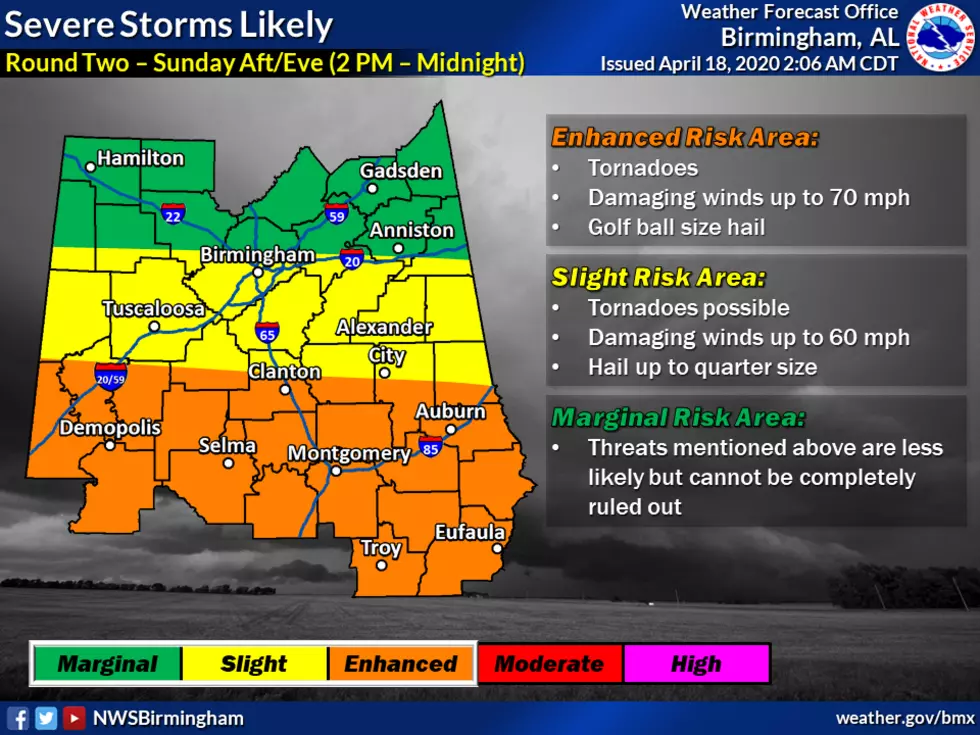
Good afternoon from the Townsquare Media Tuscaloosa weather center. Our team has been closely monitoring the potential for severe weather going on now through this evening. The National Weather Service currently has our listening areas under a Hazardous Weather Outlook for now, through this afternoon, into the evening, and even into the overnight hours. At the time of this blog post, the time threat zone is from 3 pm until 2 am. However, for our listening areas, some parts will be affected from 3 pm to 9 pm and then 6 pm until Midnight. It is best to be weather aware today because various parts of our listening area are under some sort of level of risk.
According to the National Weather Service, the levels of risk are:
Moderate Risk: Strong Tornadoes, Damaging winds up to 80 mph, and golf ball-sized hail.
Enhanced Risk: Tornadoes, Damaging winds up to 70 mph, and golf ball-sized hail.
Slight Risk: Damaging winds up to 60 mph and quarter-sized hail.
Marginal Risk: Threats mentioned above are less likely but cannot be completely ruled out.
Also, we have an additional threat of severe weather on late Wednesday evening into Thursday.
(Source) For more information from the National Weather Service, be sure to view their Facebook page by clicking here.

KEEP READING: What to do after a tornado strikes
More From Catfish 100.1